Project summary
Since 1997, the broad objectives of the Aerial Archaeology in Jordan project have remained to discover, record, monitor, map, and interpret a variety of Jordanian landscapes and publish our results, in recent years the objectives have expanded to include monitoring archaeological and cultural sites, as the threats to them have increased so dramatically over a quarter of a century. The demand on all historic landscapes has increased exponentially in the past quarter of a century as a result of population expansion and the demand for food, water and housing. Thanks to the collaboration with CBRL in Amman and with many of the excavation survey teams, and the Department of Antiquities (Jordan), the project monitors and records the conditions of archaeological sites in Jordan which would otherwise be lost.
The project is now entering an exciting new phase. Over the coming years, it will focus on training and workshops for Jordanian archaeologists and participants from across the Middle East and North Africa, particularly from Oman and Egypt.
Project details
Location: Jordan
Year(s): 1997- to present.
Project director(s): Bob Bewley & Firas Bqa’in
Co-Directors, Training in Aerial Archaeology in the Middle East and North Africa (TAAMENA) Project
Lead institutions and funding:
- The project has benefitted from the support of the Department of Antiquities, Jordan, as well as the Council British Research in the Levant (CBRL) and its Amman Office for which we are very grateful.
- The wonderful support from the Royal Jordanian Air Force.
- APAAME gratefully acknowledges the financial support of The Augustus Foundation, The Packard Humanities Institute, Australian Research Council, The British Academy, The Palestine Exploration Fund, The Prehistoric Society, The Robert Kiln Charitable Trust, Seven Pillars of Wisdom Trust, Society of Antiquaries of London, The University of Western Australia, Research Grants Fund and private donations.
Project description
The landscapes of the Middle East have undergone an astonishing transformation as a result of population growth: Jordan’s population has risen from c. 340,000 in 1943 to over c. 6 million today.
The impact of this has been an increase in damage and disturbance to archaeological sites, as a result of the intensification of agriculture, city, town and village expansion and an increased demand for land and water. Many archaeological sites have thus been destroyed or damaged before they can be investigated, hence the need for continued monitoring of sites by using aerial reconnaisance.
The broad objectives of the Aerial Archaeology in Jordan project have remained the same since 1997 – to discover, record, monitor, map, and interpret a variety of landscapes and publish our results. The methodology and results have been highly successful, working through CBRL in Amman, and collaborating with many of the excavation survey teams, and the Department of Antiquities, in Jordan.
Updates on recent aerial survey seasons, conducted in March 2024 and November 2024
Despite the ongoing war between Israel and the people of Gaza, we were impressed by the unwavering support of the Royal Jordanian Air Force (RJAF), which not only permitted us to fly but also provided a total of 15.1 hours over four flights. During these missions, we photographed an estimated 160+ sites and took 6,143 images. The photographers in 2024 were Firas Bqa’in, Bashar Tabbah and Robert Bewley.
Expanding Our Reach
Our flight planning strategy is driven by three key factors:
- Exploring previously unvisited or rarely surveyed areas.
- Collaborating with researchers based in Jordan or working on survey projects in the country.
- Monitoring sites for damage and threats.
This approach shaped our flights in March and November, taking us west and south in March, and as far east as we have ever been in November, with thanks to targets provided by Dr Alex Wasse and Ahmad Alghizawat.
Challenges and Discoveries
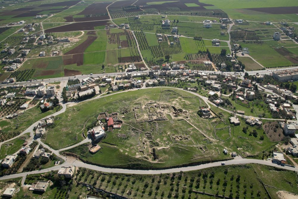
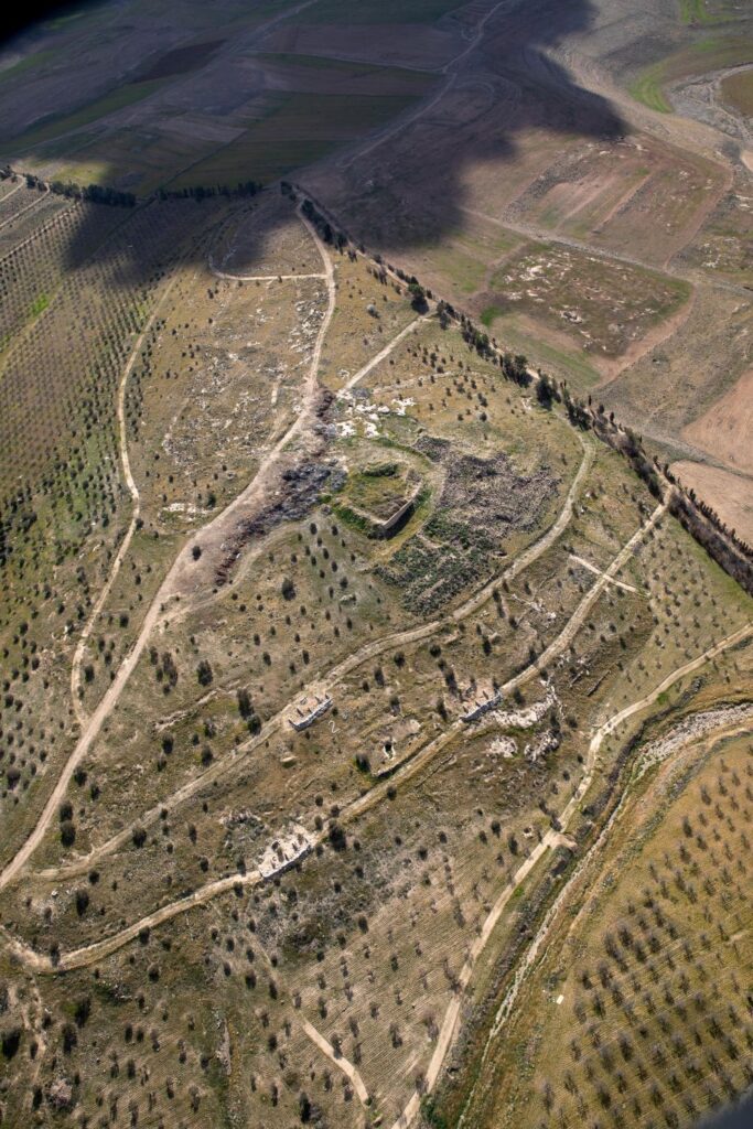
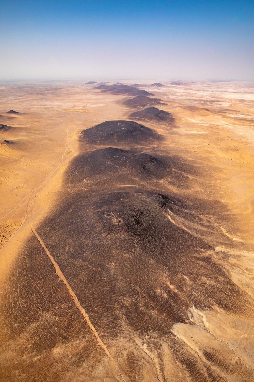
The March season was marked by exceptional weather, with the high limestone plateau between Amman and Kerak greener than we have seen in 27 years, see Figures 1, 6 and 7. However, a major challenge arose due to GPS signal jamming, a consequence of the ongoing conflict. While flying just west of Amman, our GPS systems incorrectly placed us in Cairo! This significantly delayed site cataloguing, as we lacked track logs to pinpoint locations.
This challenge influenced our decision to fly east in November, where, fortunately, no GPS disruptions occurred.
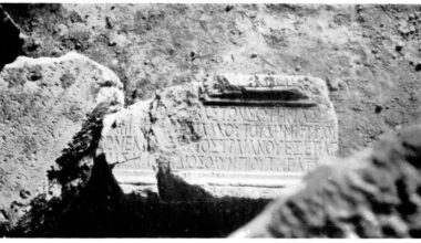
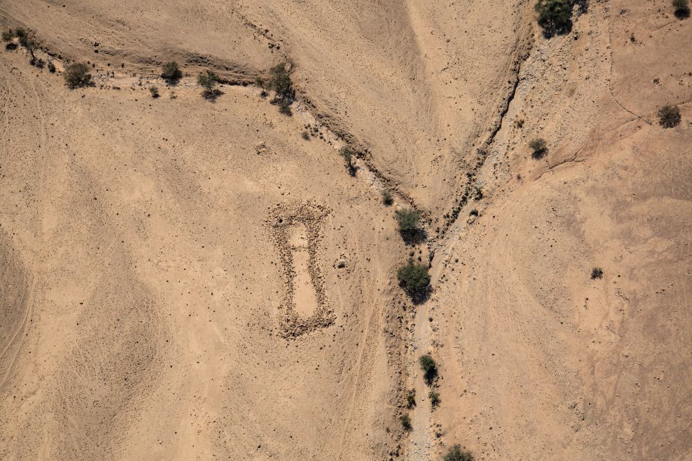
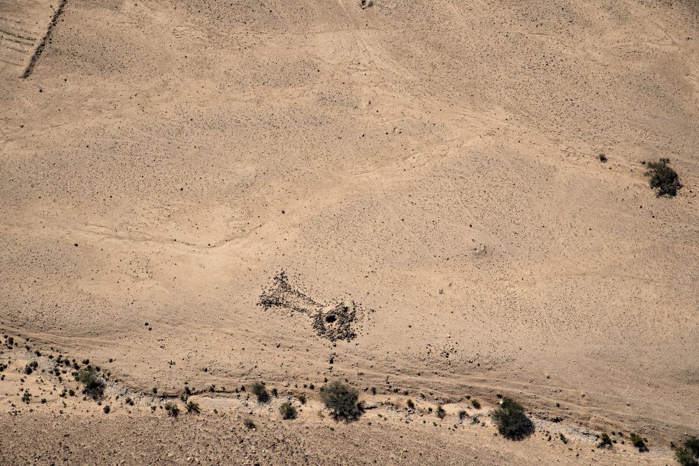
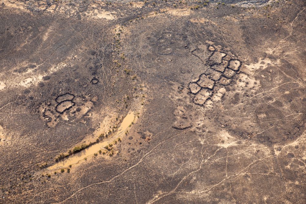
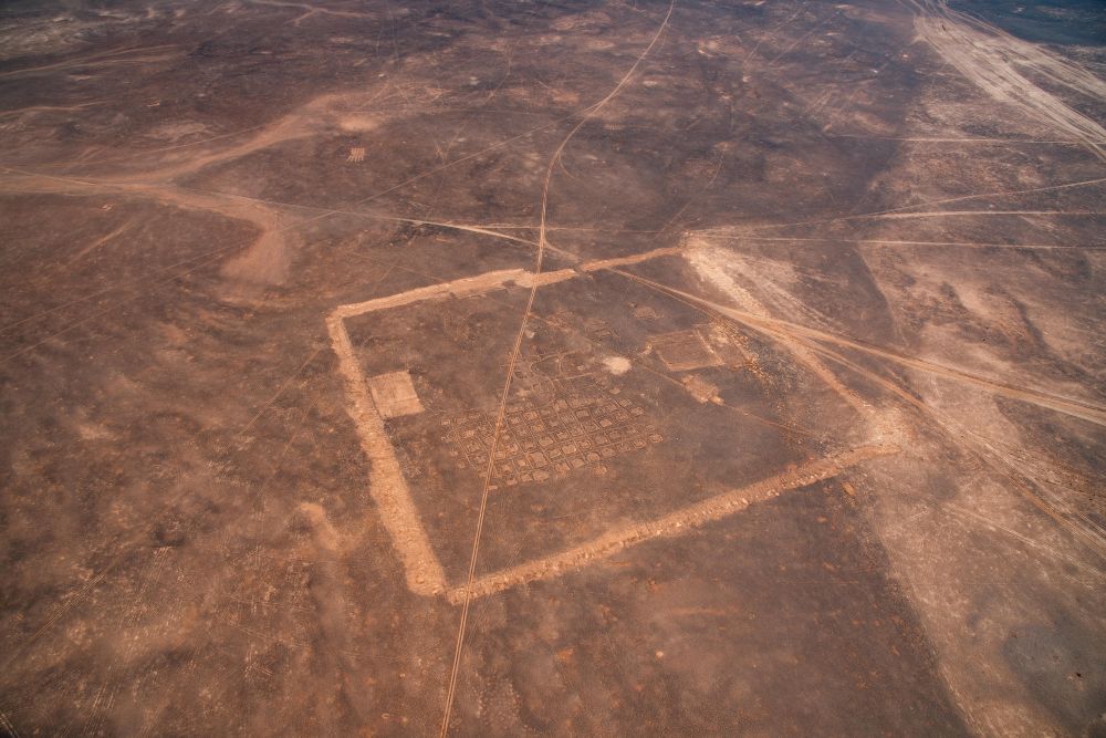
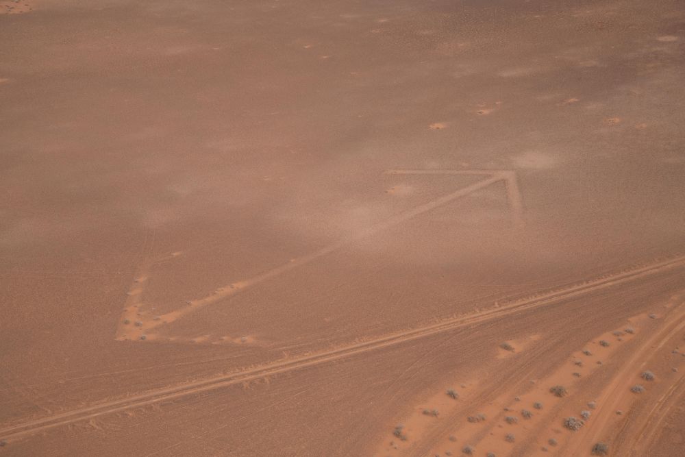
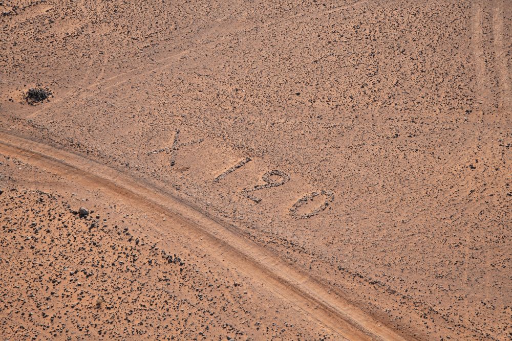
We discovered many sites previously unrecorded, see Figure 2, but of particular note are the so-called ‘mustatil’ and keyhole tomb, see Figures 3 and 4.
Two time periods which have received less attention than others have been the Islamic period, see Figure 8, and we hope to redress this imbalance in the future. The other is the twentieth century archaeology and there are many exciting developments here, see Figures 9 to 12, looking at the early twentieth century air mail routes between Cairo and Baghdad.
Looking Ahead: 2025 and Beyond
We are already planning the training and workshop events as well as additional aerial survey seasons in 2025 and 2026, with funding proposals submitted and pending approval.
Acknowledgements
We extend our deepest gratitude to:
- HRH Prince Hassan bin Talal, our esteemed Patron.
- HRH Prince Feisal’s office in Amman for their valuable support.
- The Jordanian Army and all the staff and pilots of the Royal Jordanian Air Force, whose dedication has been instrumental to our success.
- Our funders, including The Augustus Foundation, The Society of Antiquaries of London, and The British Academy, whose generous support has made this project possible.
- The Department of Antiquities in Jordan (DoA) for all their support and encouragement. CBRL Amman has been our home from the very beginning, and we look forward to an even closer collaboration in the future.
Accessing the Imagery
All the 2024 imagery has been catalogued and is available on our Flickr archive: APAAME. The AAJ project works with the EAMENA project which documents sites, allows access to its database and assesses the condition of archaeological sites.
Project bibliography
Bewley, Robert. 2020. Aerial archaeology in Jordan. Bulletin of the Council for British Research in the Levant 2018-2019, p 24.
APAAME. http://www.apaame.org/
Photography by Firas Bqa’in, Bashar Tabbah and Robert Bewley

Published:07 January 2024